GIS Technology Enhances Public Service throughout Los Angeles County
RECLASSIFICATION PROPOSALS ARE UNDERWAY FOR THOSE PERFORMING GIS RELATED WORK
Our members in several departments throughout the County of Los Angeles, such as the Department of Regional Planning, Parks & Recreation, Public Works, Beaches & Harbor, ISD, and Office of the Assessor, use Geographic Information Systems (GIS) software technology that allows vast amounts of information to be linked to geographic locations. GIS integrates hardware, software, and data for capturing, analyzing, and displaying all forms of geographically referenced information.
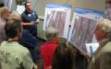
This year’s Annual GIS Day was held on November 14, 2012 in Alhambra. It gave our members, students, and residents from the County the opportunity to share how they use GIS technology and learn how this technology provides services during emergency response, social services, and administration services to the County. The GIS web mapping applications are essential to the business operations of the County. For example, GIS-NET3 allows CAPE-member Planners from Regional Planning to visualize and investigate features ranging from one or more parcels up to an entire community, or the County as a whole. It’s a necessary tool for them to use when counseling and servicing the public.
GIS is not only applicable to County departments, but it’s a vital technology that County residents use in their daily lives. When people use a mapping application on their smart phone or tablet, they are using GIS. This technology is also used when people make online purchases or use an ATM machine because it records the location of their activity. In addition, GIS technology allows County employees to provide services in a more efficient and cost-effective manner for the County and the public.
Recently, a County-wide study was conducted with the stated goal of appropriately classifying the positions performing GIS related functions. Based on recommendations from the study, a new series with eight (8) GIS specific classifications is being created. According to the County, reclassification recommendations for existing positions to the new classifications will be made as departments determine the optimal GIS structure for their respective organizations.
Several CAPE members who perform GIS related functions have contacted us with concerns about maintaining their Union representation if they are slated for reclassification. CAPE will continue to monitor the situation closely. No one should lose their Union representation as a result of reclassification.
The dedication and commitment of our members performing GIS work has continued to enhance the quality of public service in the County of Los Angeles. Anyone with concerns about how pending reclassification proposals may impact them should contact a CAPE Business Agent immediately.
[CAPE Members: Please share this website with non-members at your work location]
©CAPE [Terms of Use]


